Resource Library

Bookmark and Share

The Smithsonian Ocean Portal

The Monarch Butterfly Manual


The U.S. Fish and Wildlife Service and Proteccion de la Fauna Mexicana A.C., a Mexican non-governmental organization, developed The Monarch Butterfly Manual, Royal Mail: A Manual for the Environmental Educator. This manual offers activities and labs, arranged by grade level, that promote conservation of the Monarch Butterfly.

Investigating Biodiversity

in Subject: , ,
Key Term: 
Level: 
Resource Type: 
Topic: 

Through the application of math concepts students examine the degree of biodiversity that exists in the everyday environment in order to develop an understanding of how scientists classify organisms. They also explore why biodiversity is important for living things.

Alaska Native Knowledge Network Lesson Plans

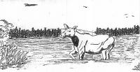
moose.jpg

This resource contains lesson plans that integrate Native knowledge and scientific issues relating to the environment. Although there are multiple lessons plans, "Moose" and "Digging and Preparing Spruce Roots" are the most high school appropriate.

ESA21: Environmental Science Activities for the 21st Century


ESA21 offers over 40 activities that engage students in a variety of environmental topics. The activities rely on a mixture of hands-on, field and Web-based experiences that give students a deeper understanding of the issues. Topic areas include: air, environmental science basics, the biosphere, earth, energy, home life and pollution.

Creating Schoolyard Habitats: A How-To Guide

NWF Logo.gif

The National Wildlife Federation’s "How-To Guide" for Schoolyard Habitats walks instructors through the necessary steps to create a successful and sustainable wildlife garden, provides information on teaching in an outdoor classroom and offers resources to help create and maintain a habitat.

Hands on the Land

Hands on the Land Logo.gif

Hands on the Land is a national network of field classrooms connecting students and teachers to their public lands and waterways. On the Web site, you can: search for Hands on the Land member sites by agency, state or keyword; access educator resources including curriculum, lesson plans and other materials; browse environmental monitoring programs to see how students are helping to protect our land, air and water and participate in e-Learning courses for students and teachers, including online field trips.

Geothentic - Using GIS to explore environmental topics

5-18-2009 11-25-06 AM.jpg

The University of Minnesota has partnered with National Geographic to develop this innovate GIS mapping tool for educators. This website will help teachers use real data to convey how decisions are made and better understand geographical impacts on society.

Using GIS for Conservation in Africa


This National Geographic lesson uses maps created by the Wildlife Conservation Society and helps students understand how GIS and other mapping tools have helped researchers develop programs to mitigate human development for conservation efforts.

Mapping Biodiversity in an Estuary


This activity from NOAA uses Google Earth to explore the Rookery Bay National Estuarine Research Reserve in Naples, Florida. Students produce a biodiversity concept map of the estuary with organism profiles based on readings and research.