
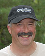
Paul Tweed - Wildlands School
Submitted by Anonymous on Thu, 02/12/2009 - 10:47.
 Paul Tweed of Augusta, Wisconsin has been focusing his educational career since the early ‘90s around field research and incorporating technologies like GIS into his classroom. When Tweed was first introduced to GIS technology, he immediately saw the educational potential of incorporating quick mapping tools into his classroom. Soon after exploring GIS himself, he taught a field research course in biology at Augusta High School.
As his course developed, Tweed’s students took on larger projects, including a project partnering with the Department of Natural Resources (DNR) to monitor rehabilitated black bear cubs from captivity over the course of seven years. By tracking the bears, students could see where the bears traveled, hibernated, and fed while also understanding how captivity affected their livelihoods after re-introduction. Today, the DNR has restructured their black bear rehabilitation program to reflect the reports and suggestions presented by Tweed’s students. Innovative projects such as this one have allowed Tweed to cover topics such as animal behavior, habitats, wildlife management and of course, GIS and GPS technology. As he said in an interview with the Environmental Systems Research Institute (ESRI): “It becomes a much larger focus than just putting dots on a map."
Projects like these soon developed into a charter school based on this course, called the Wildlands School. Though it is not a requirement to use GIS in individual projects, about 80% of the students at this school utilize GIS in their independent research. Projects range from mapping local lakes to studying population dynamics of wildlife in the area. Tweed’s projects have inspired students and teachers to take education outside, and have also helped organizations like the DNR adapt to new information provided from research.
In order to incorporate GIS technology into your lessons, Tweed suggests first having the self-motivation to learn GIS software and pursue a project. With practice, he found better uses of the technology and found how to best collaborate with organizations that could benefit from his class’ projects, like the DNR. Being pro-active is key to coordinate projects with researchers and land managers. Read more about his projects and be sure to visit the Wildlands School website to see what they are doing today.
For more ideas, click here to visit our GIS resources containing lesson plans, activities, and articles.
Information for this article was provided by ESRI and an interview with Paul Tweed.
